Sichuan Guandie Construction Co., Ltd.
INTEGRITY | CRAFT EXCELLENCE | BEYOND SELF
NATIONAL SERVICE HOTLINE
+86 13688238666
A comprehensive river-basin treatment on the Haihe Plain—levee reinforcement, dredging, roads, traffic-safety and greening in one integrated hydraulic delivery.
Key parameters and scope of the project
| 项目要素 / Key Fact | 内容 / Detail |
|---|---|
| Project Type | Water & Environment · Comprehensive River Treatment |
| Contract Value | ¥122 million |
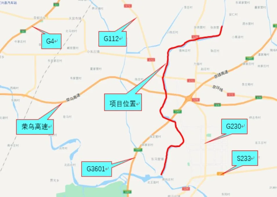
| Location | Gaobeidian, Hebei (east of Dingxing County), on the Haihe River Plain |
| Elevation | 13–43 m; flat terrain, sloping gently NW–SE |
| Climate | Warm-temperate, semi-arid continental monsoon; prevailing SW wind |
| Temperature | Mean annual 11.7°C (warmest month 26°C, coldest -4.9°C) |
| Rainfall | Mean annual 527.2 mm, over 80% of it from June to September |
| Frost-free / Sunshine | 186 frost-free days; 2,685.8 mean sunshine hours per year |
| Hydrogeology | Piedmont inclined-plain hydrogeological zone of the Taihang Mountains; aquifer floor ~20 m deep, deepening eastward |
| Aquifer / Water Table | Mainly gravel and sand; mean groundwater depth 18.6 m, calcium-bicarbonate type |
| Groundwater Flow | NW–SE, broadly following the terrain |
| External Access | G4 Beijing–Hong Kong–Macao Expressway, G112, Rongcheng–Wuhai Expressway, G3601, G230 and S233 provincial roads cross or ring the site; township and village roads intersect locally |
| Levee-top Road | Partly cement-surfaced and partly gravel on the right bank, ~3–4 m wide — adequate for equipment and material access |
| Scope of Works | Levee reinforcement, channel dredging, levee-top and connecting roads, traffic-safety facilities and greening |
| Client | Sinohydro Bureau 5 |
Location · Hydrogeology · External access · Scope of works
The project lies east of Dingxing County, Gaobeidian, on the Haihe River Plain. The terrain is flat and slopes gently from north-west to south-east, at an elevation of 13–43 m.
The area belongs to the warm-temperate, semi-arid zone of the eastern Asian continental monsoon region, with a strongly monsoon-influenced climate: mean annual temperature 11.7°C (warmest month 26°C, coldest -4.9°C); mean annual rainfall 527.2 mm, over 80% of it between June and September; 186 frost-free days and 2,685.8 mean sunshine hours a year; winds are mostly southerly and south-westerly, with a prevailing south-westerly direction.
The site lies in the piedmont inclined-plain hydrogeological zone of the Taihang Mountains. The aquifer floor is about 20 m deep and deepens eastward; the water-bearing strata consist mainly of gravel and sand.
Groundwater flows roughly in line with the terrain, from north-west to south-east. It is predominantly calcium-bicarbonate type, with a mean depth of 18.6 m.
The surrounding area has a dense transport network: the G4 Beijing–Hong Kong–Macao Expressway, G112, the Rongcheng–Wuhai Expressway, G3601, G230 and S233 provincial roads cross or ring the project area, while township and village roads form an interlaced local network.
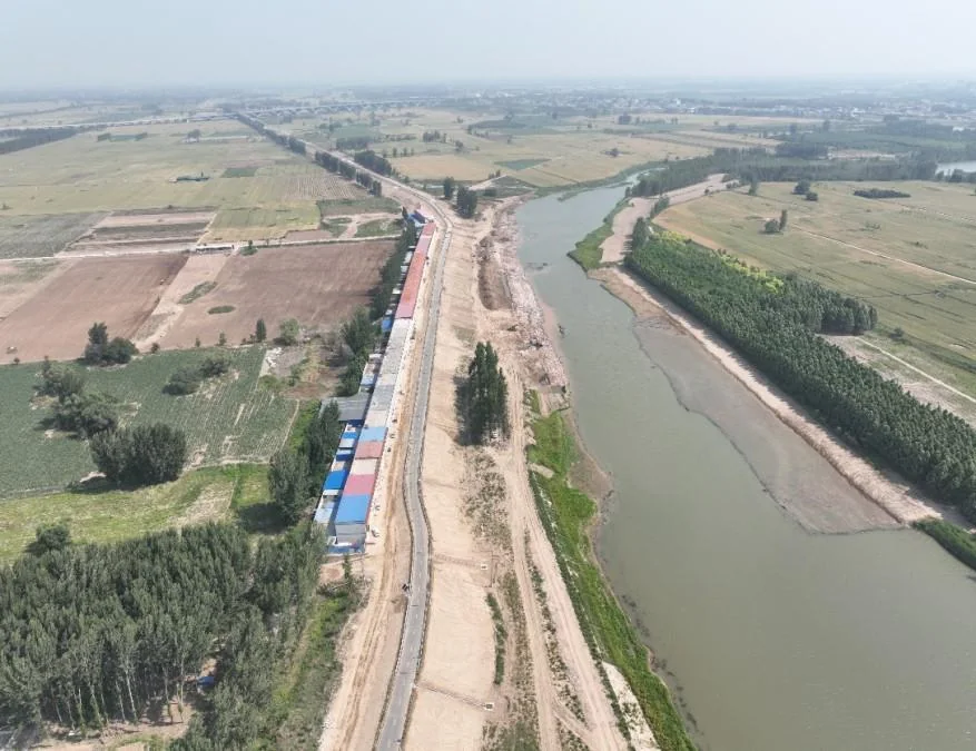
On the right bank the levee-top road is partly cement-surfaced and otherwise gravel, about 3–4 m wide — sufficient for early access by equipment and materials.
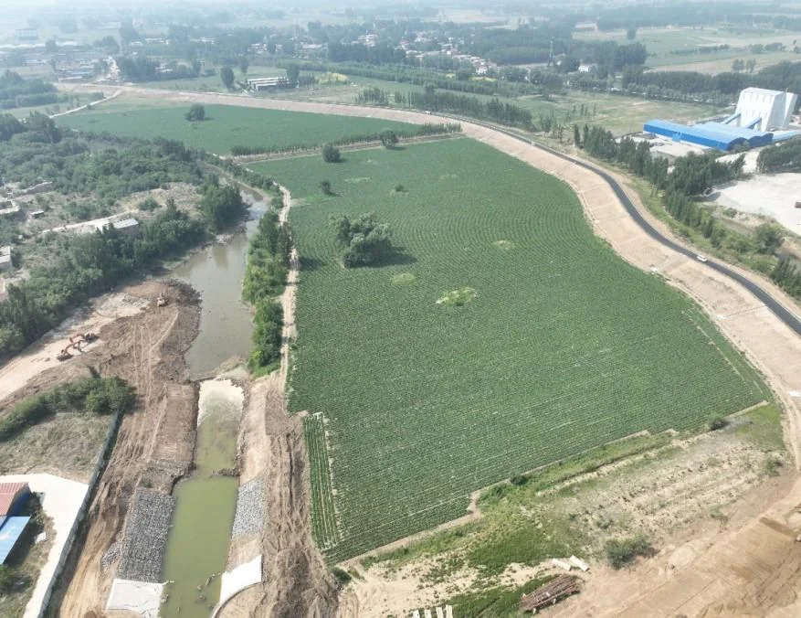
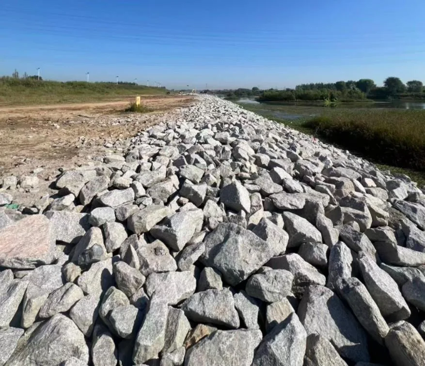
Delivered as a one-stop hydraulic package, the works mainly comprise levee reinforcement, channel dredging, levee-top and connecting roads, traffic-safety facilities and greening. Together they systematically improve the river’s flood-conveyance capacity and the riparian ecology, and the project has been handed over and accepted smoothly.
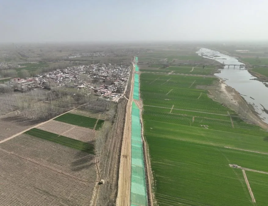
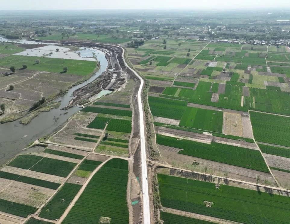
Aerial and on-site records of the channel treatment and the levee slope protection
We bring experience, teams and strength to win together on your project.